PA – NAGTES Meeting, Day 3

Leave a comment

June 1, 2013 by Dr. G

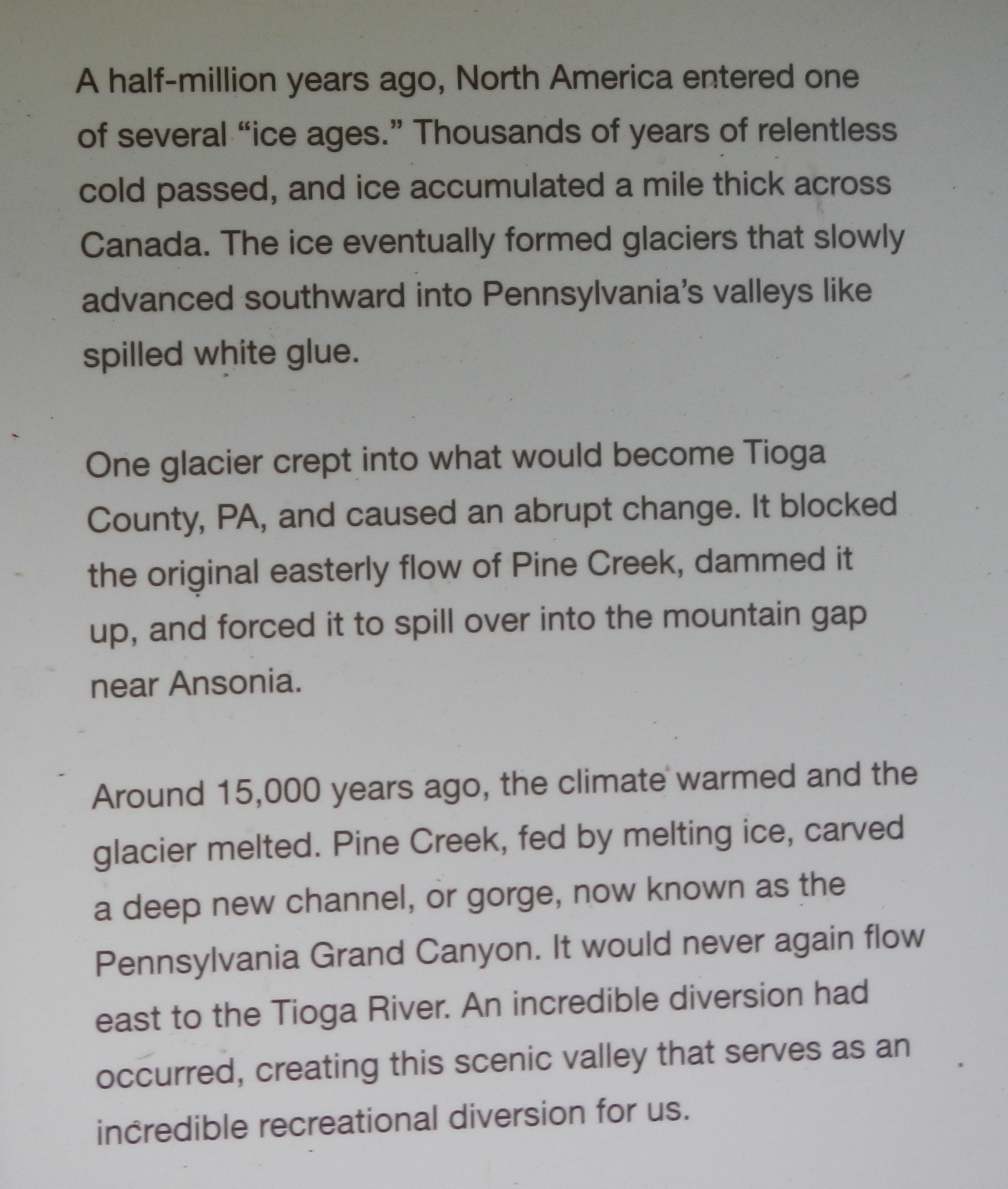
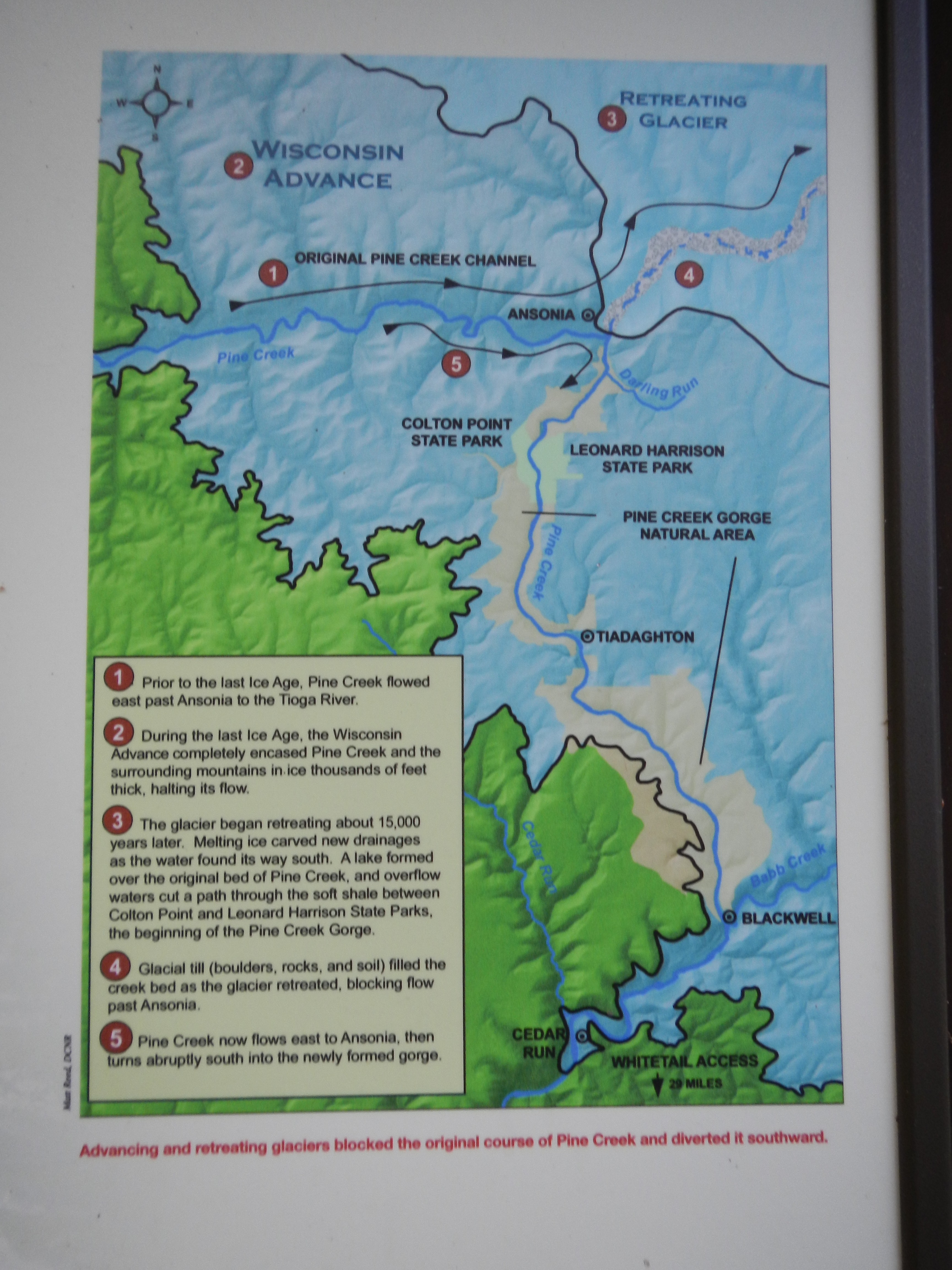
Today was the third and final full day of the NAGT-Eastern Section Conference. Today’s fieldtrip was to the Grand Canyon of Pennsylvania – specifically, to the Leonard Harrison State Park to view the Pine Creek Gorge. This glacially-carved canyon extends for 47 miles in length and is 1450 feet at its deepest and almost one mile wide.

This sign describes the geologic history of this recreational area.

This sign describes the geologic history of this recreational area.

A map showing the details described above (*students - notice the value of taking pictures of any signage you see in the field!).

A map showing the details described above (*students – notice the value of taking pictures of any signage you see in the field!).

An early stop today - a lookout at Rattlesnake Rock along the Pine Creek Rail Trail.

An early stop today – a lookout at Rattlesnake Rock along the Pine Creek Rail Trail.

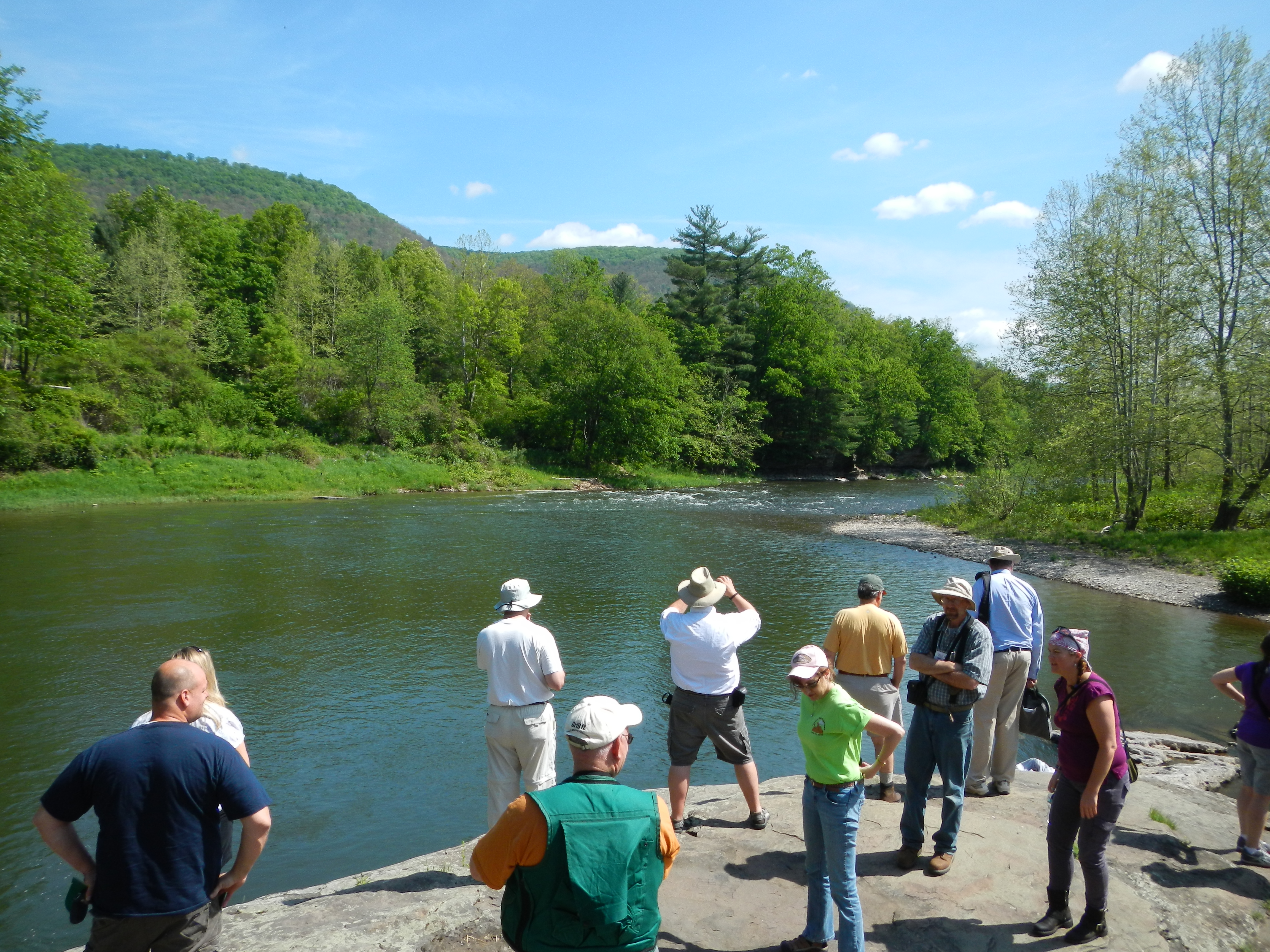
There was no way to fit the entire view of the “Grand Canyon” in one photo frame, but hopefully, this short video panorama I took will give you an idea of the scale of this feature –  not just a state park, but also a National Natural Landmark (see also the PA listing).

This park did an excellent job with signs, a statue, and informational video educating park visitors as to the important role of the Civilian Conservation Corps played in the history of this park.

This park did an excellent job with signs, a statue, and informational video educating park visitors as to the important role of the Civilian Conservation Corps (CCC) played in the history of this park. Check out the information on the PBS website to learn more about this group and search the map to find locations of their completed projects. This is a program I want to spend some time learning more about one day, especially since so many of their projects were completed on public lands.

As you can imagine, the pathways down to the river were quite steep.  With only a short amount of time at this site, I heeded the warning sign and did not descend down to the river.

As you can imagine, the pathways down to the river were quite steep. With only a short amount of time at this site, I heeded the warning sign and did not descend down to the river.

The evening finished up with a guest speaker, dinner and awards ceremony. The speaker was from an engineering firm, and his talk was titled “Using Digital Photogrammetry for Rock Cut Slope Design.” I enjoyed the talk and was able to follow the surveying technique used. When I was an undergraduate student, I spent two summers as an intern for NOAA’s Field Photogrammetry unit in Norfolk, VA, so I had previous office and field experience working with this technology (follow this link to learn about careers on photogrammetry).

Another exhausting day! It’s amazing what a little fresh air, some geology and good company can do to a person.  But it is now time to pack up and head to my next destination – State College – for a series of grant meetings.

One last parting shot from the Pennsylvania Grand Canyon.

One last parting shot from the Pennsylvania Grand Canyon. Note the Rail-To-Trail path that follows on the right side of the river.

Leave a Reply

Fill in your details below or click an icon to log in:

WordPress.com Logo

You are commenting using your WordPress.com account. Log Out /  Change )

Facebook photo

You are commenting using your Facebook account. Log Out /  Change )

Connecting to %s

Enter your email address to follow this blog and receive notifications of new posts by email.

Categories

%d bloggers like this: