Iceland – Chautauqua, Day 5

1

May 13, 2013 by Dr. G

Racks and racks of cod drying out over one of the geothermal fields in southwest Iceland.

Racks and racks of cod drying out over one of the geothermal fields in southwest Iceland.

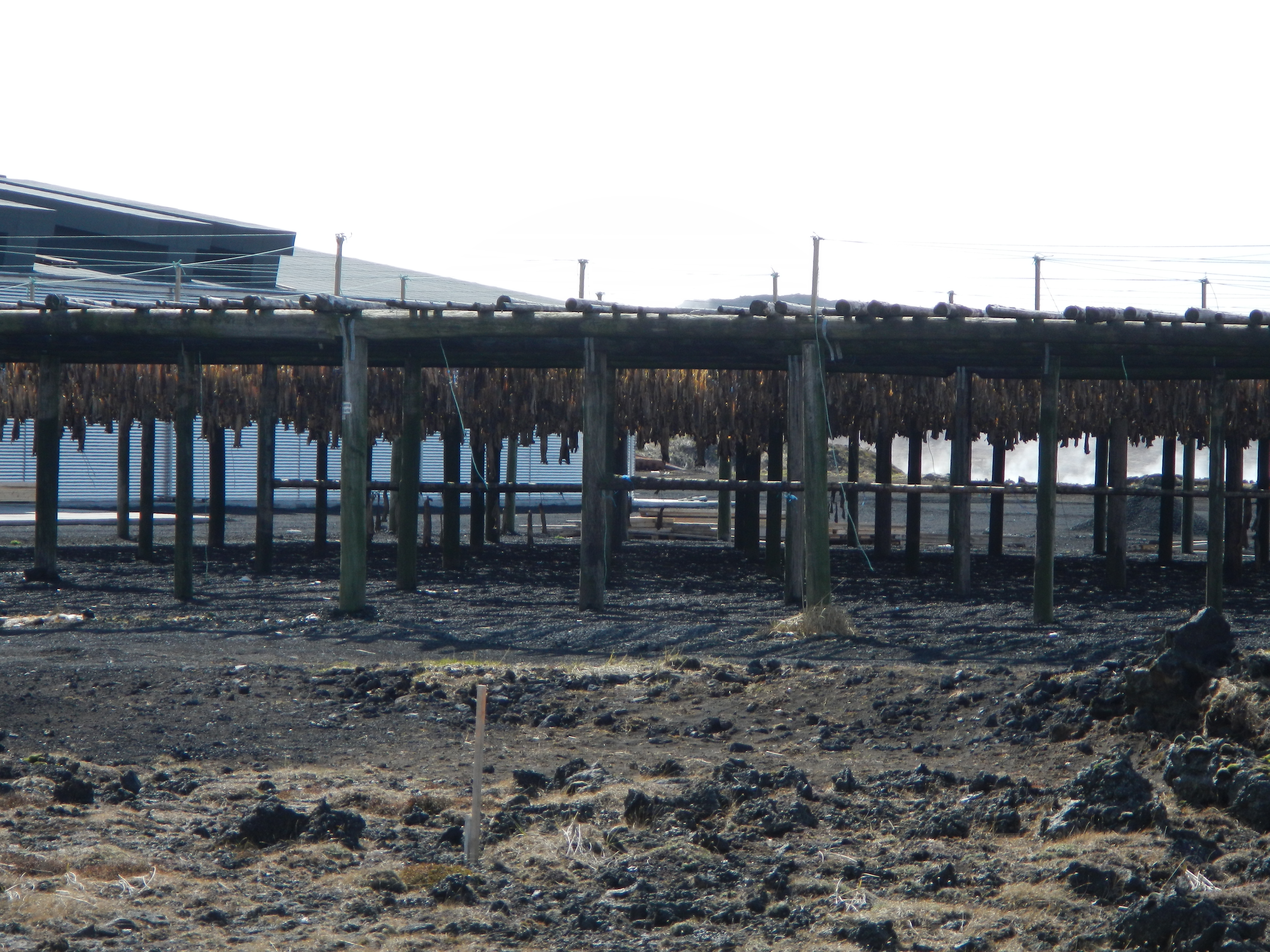
We packed in quite a few sites today on the Reykjanes Peninsula before heading to the airport for our 5PM flights back home (almost all flights to the USA depart exactly at 5PM every day on IcelandAir).  In addition to driving through a fishing village and seeing (and smelling) the drying cod pictured above, the geological sites and views were amazing, as always.

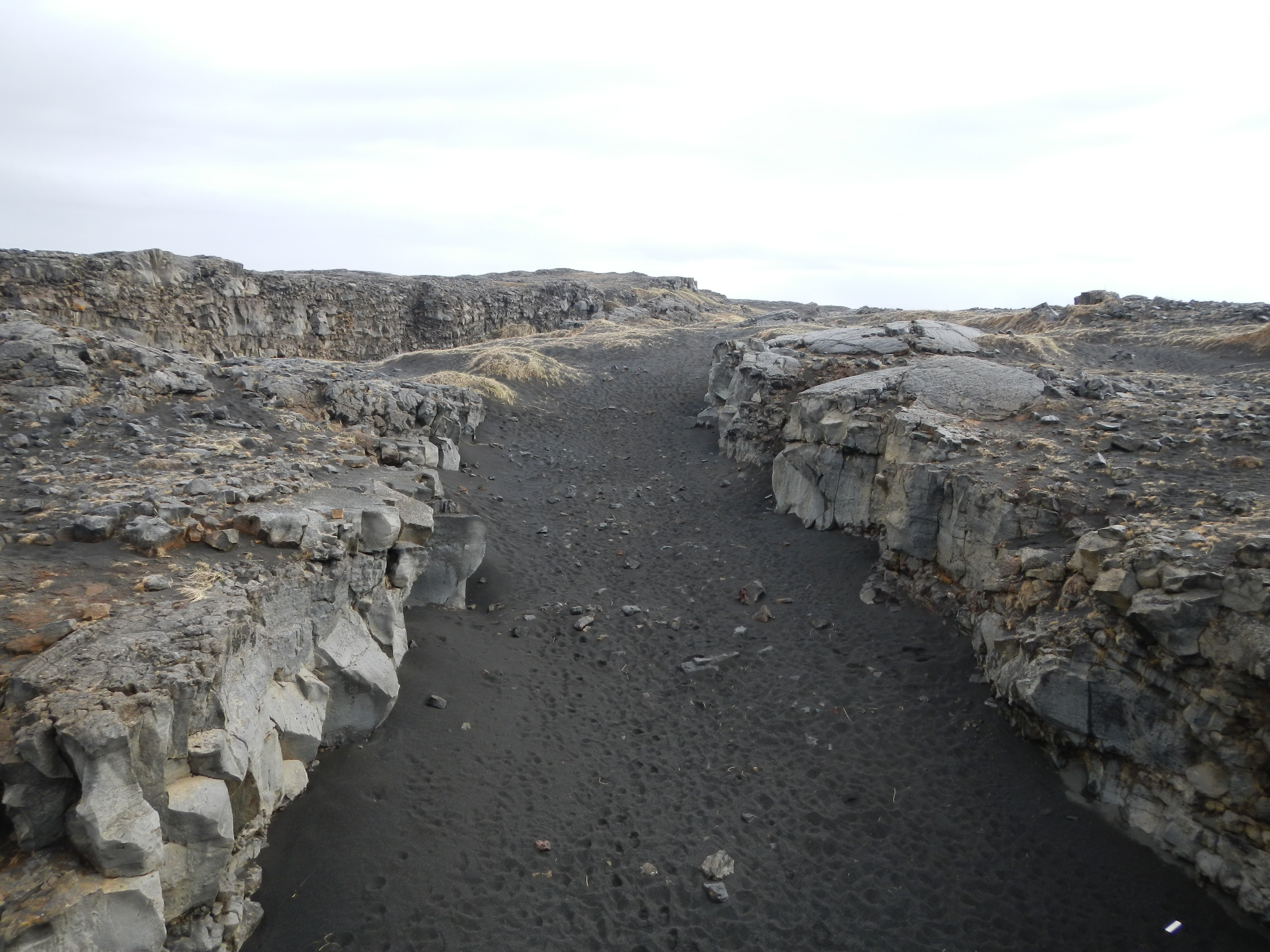
Stop 1 was to The Leif the Lucky (or Miðlína) Bridge, spanning the Álfagjá rift valley (60 feet wide and 20 feet (6.1 m) deep) near Grindavik.  This rift is wider than the one we visited earlier in the week that we could stand across, but it was still just as amazing to cross over from North America to Eurasia – and back and forth!

Standing in the middle of the mid-ocean ridge (now you don't get to say that every day!).  The view is looking "inland" towards the north.

Standing in the middle of the mid-ocean ridge (now you don’t get to say that every day!). Yet another day that I spend on two tectonic plates.  The view is looking “inland” towards the north.

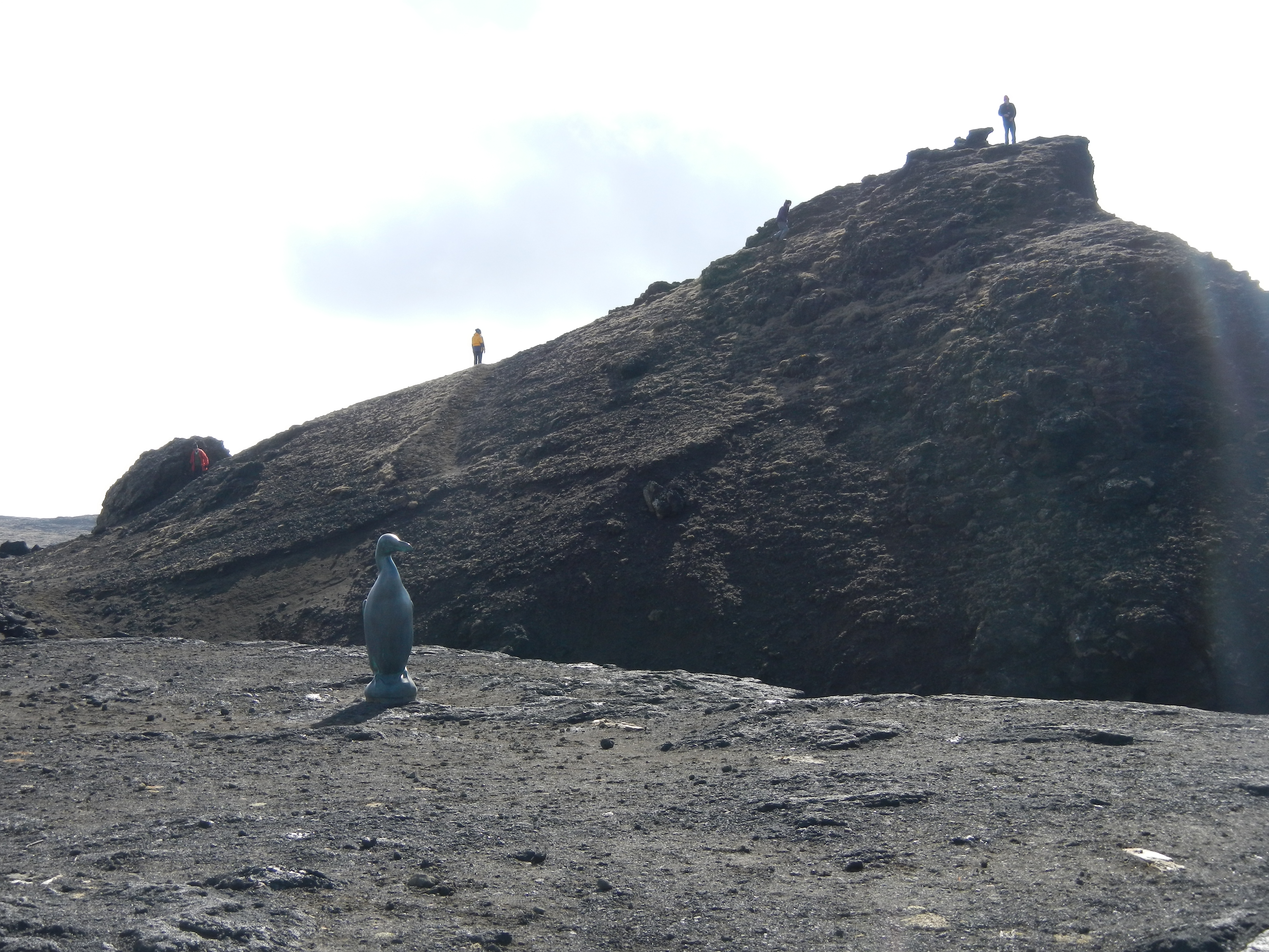
Stop 2 was a beautiful site along the shore that contained some excellent columnar jointing, pillow basalts, and a little history.  At this site is a statue of a Great Auk, a bird that went extinct in the mid-19th century.  The site was a significant migration point for this flightless bird just under three feet in height.  It was off this coast that it has been reported the last two Great Auks in existence were killed by humans.

The Great Auk statue on the left, looking out over the ocean.  Behind the statue is the outcrop I climbed to take the photo below.

The Great Auk statue on the left, looking out over the ocean. Behind the statue is the outcrop I climbed to take the photo below.

I climbed up an outcrop to capture this view (the Great Auk statue is just off to the right).  Here, you can see how high the winter waves reach, causing the erosion of the shoreline.

I climbed up an outcrop to capture this view (the Great Auk statue is just off to the right). Here, you can see how high the winter waves reach, causing the erosion of the shoreline.

Our next stop was to Gunnuhver, a geothermal field with a variety of geothermal features.  There is a great tale of Gunna, the ghost that is buried in these fields of fumaroles, mud pots, and hot springs.  Check out this video I snapped of the bubbling mud pots.

That's me, right next to one of the vents on this hydrothermal field.  Kids, do not try this at home!  Not only could the rocks be too hot to touch and burn your hand, the rocks you walk on could melt the soles of your hiking boots.

That’s me, right next to one of the vents on this hydrothermal field. Kids, do not try this at home! Not only could the rocks be too hot to touch and burn your hand, the rocks you walk on could melt the soles of your hiking boots.  Clearly, that wasn’t the case in this location.

Our final spot was the Blue Lagoon, a very popular place for tourists that want to soak up the mineral-rich water warmed by the local geothermal energy.  Some of my colleagues took a quick dip in the pool to relax for their flights back to the USA, while myself and others took the time to connect professionally and share teaching experiences and strategies (these discussions are so important to my development as a classroom instructor and professional in the geosciences).

Alas, the fun had to come to an end.  It was time to pack up and head off to the Keflavík International Airport for the long flight home.

But here is one more amazing geologic photo from the day.  Check out this volcanic mountain that is demonstrating rifting occurring right in the middle, forming a graben!  The depressed graben is the foundation for all the radio/communication towers.

Some of my photos were taken out of a moving bus window.  I'm glad this one came out - it is an impressive graben that students can easily visualize!

Some of my photos were taken out of a moving bus window. I’m glad this one came out – it is an impressive graben that students can easily visualize!

One thought on “Iceland – Chautauqua, Day 5

  1. […] wide the features extend.  For example, the Google Earth image below shows the site I visited on Day 5 of my short course where we could walk across the two plates.  Notice all of the diagonal […]

    Like

Leave a Reply

Fill in your details below or click an icon to log in:

WordPress.com Logo

You are commenting using your WordPress.com account. Log Out /  Change )

Twitter picture

You are commenting using your Twitter account. Log Out /  Change )

Facebook photo

You are commenting using your Facebook account. Log Out /  Change )

Connecting to %s

Enter your email address to follow this blog and receive notifications of new posts by email.

Categories

%d bloggers like this: